Repost: Written by me, originally published by Trufi Association
Trufi has completed mapping the public transport network in Nouakchott, the capital of Mauritania: 59 routes, 454 stops, and 1,987 points of interest (buildings and amenities identified from 24,000 street-level photographs). The routes and data are available via OpenStreetMap, and Mapillary.
But what does it mean for Mauritania’s capital to have well-mapped public transport for the first time?
For answers to this question, we talked to two people with different vantage points of our Nouakchott project: A local mapper who lives in Nouakchott, and an international expert in urban transport.

Photo: Mapillary user abdicheine (CC BY-SA 4.0)
The Local Mapper: Vetah Mohammed el Moctar
“I hope this project will be the start of a radical change for public transport in Nouakchott,” said Vetah Mohammed el Moctar, a Mauritanian who led Trufi’s six-member on-the-ground mapping team in the city.
Moctar started the OpenStreetMap Mauritania group in Nouakchott in 2020, and continues to run the group. There are currently 33 members, including university professors, engineers, and students.
The mapping project will “definitely change public transport in Nouakchott,” he said. The unprecedented transport data can help make important decisions to make travel in Nouakchott easier and more comfortable.
In the Hands of Decision Makers
A year from now, Moctar imagines the project data having contributed to the development of public transport in Nouakchott, “if the data will have been exploited by decision-makers.”
Moctar would like to see an expansion of the work begun by Trufi in Nouakchott, to include a complete digital map of all public transport lines in Nouakchott, “including lines that connect the outskirts of the city to each other, far from the city center.”

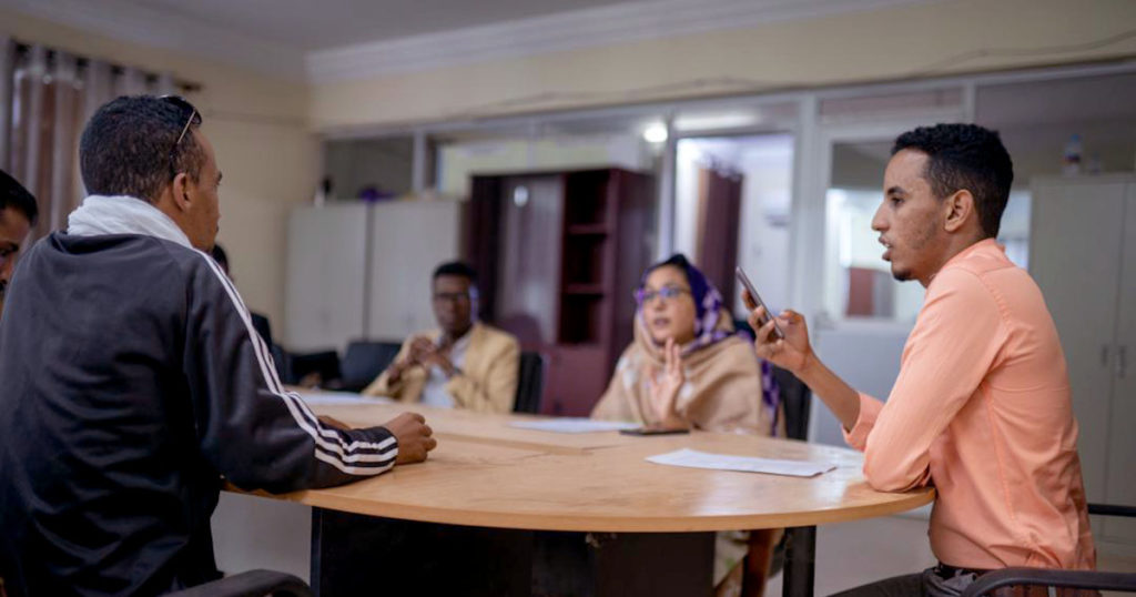
Photo: Trufi Association (CC-BY-ND)
Mapping During Ramadan
The mapping work coincided with Ramadan and high summer temperatures, testing the dedication to Moctar and his team.
“The work was very difficult,” he said. “Four days of work with the team sleeping only four hours a day. We started work at 8:00 a.m., and continued until 1:15 p.m. when the phones would stop working due to the heat. We would rest for two hours while waiting for the temperature to decrease, and we would start again in the evening and work until 7:00 p.m.”
The data collected by Moctar and his team should be analyzed, he believes, to modify “the route of the daily flow of cars and to relieve the pressure on many points in the city.”
Segue to…
The Urban Transport Expert: Fatima Arroyo Arroyo
“We are doing a diagnostic on the Urban Transport sector,” said Fatima Arroyo Arroyo, senior urban transport specialist with the World Bank (which is funding Trufi’s project in Nouakchott). “The work we’ve done with Trufi is one of the pieces to help us build that diagnostic.”
The diagnostic is an analysis of different dimensions of urban transport: the institutional level, operational level, down to the level of public transport users.
The Nouakchott data “will help to understand what areas of the cities are excluded from transport services, what areas are well-served, what are the problems with congestion, or other problems, to link all those pieces together,” she said.
Arroyo Arroyo identified several categories of stakeholders who are potential users of the open data and/or the diagnostic that will be produced by the World bank.
Government Stakeholders and Academia
The main government stakeholders are Mauritania’s Ministry of Equipment and Transport, and the “Region of Nouakchott” (the administrative unit that contains Nouakchott and the surrounding area). Both are very interested in the data analysis, she said.
Academia is also another important stakeholder for the use of this data. “We have held discussions with the local universities to make use of it. This can be an excellent way to motivate new and impactful research.”
“Traditionally the public sector has been seen as the stakeholders in the transport sector. It has been the same for sixty years,” Arroyo Arroyo said. “But in the last ten to fifteen years what we have seen is that more and more specialized actors in the tech industry and the payment industry are entering the sector.”
Non-Government Stakeholders
Arroyo Arroyo emphasizes the potential of non-government stakeholders to leverage the data now available on OpenStreetMap and Mapillary. These include transport operators, transport unions or associations, the OpenStreetMap community, and innovation hubs.
Transport operators can exploit the data to easily see where people are circulating, what are the current options for transport, and identify areas of the city that don’t have sufficient service. “There could be opportunities for them also to serve populations,” she said, “and be more strategic in the way they develop their business.”
With this new mapping data, tech solution providers have the opportunity to provide specialized contracted services to the transport sector, such as tracking, mapping, and apps for transport users that provide payment and booking.
“That’s more for the future,” she said. “But we are kind of putting the first stone in a building, helping to build that foundation of innovation.”


One thought on A “Foundation of Innovation” – Trufi has Mapped Nouakchott’s Public Transport Network
Pingback: weeklyOSM 567 | weekly – semanario – hebdo – 週刊 – týdeník – Wochennotiz – 주간 – tygodnik